Elizabeth Kolbert's important recent article, "Watermark: Can southern Louisiana be saved?" in The New Yorker is unfortunately not available online, and since it appeared in an issue about two weeks old, it's not going to be easy to find, but if you can seek it out, it's well worth the effort. This is the first thing I've read since Katrina that made me think that rebuilding New Orleans may not be such a good idea. I'm still not totally swayed, but I do now have serious doubts.
I'm going to put some excerpts from the article here. Bear in mind that I'm typing it in, so all typos are mine, and are not the responsibility of the legendary copy editors at the magazine. Also, any illustrations, maps, links and footnotes have been added by me.
Five thousand years ago, much of southern Louisiana did not exist. A hundred years from now, it is unclear how much of it will remain. The region, it is often observed, is losing land at the rate of a football field every thirty-eight minutes. Alternatively, it is said, the area is shrinking by a large desktop's worth of ground every second, or a tennis court's worth every thirteen seconds, or twenty-five square miles a year. Between 1930 and 2000, some 1.2 million million acres, an area roughly the size of Delaware, disappeared. Hurricanes Katrina and Rita stripped away an estimated seventy-five thousand acres -- a loss as big as Manhattan and Brooklyn combined. The U.S. Geological Survey has published a map[PDF] illustrating the process. Areas that have already vanished appear in red, and areas that are expected to vanish by 2050 in yellow. On the map, the southern coast looks as if it were on fire. According to the U.S. Army Corps of Engineers, "The rate at which Louisiana's land is converting to water is probably the fastest in the world."
Start to dig in Plaquemines Parish, or almost anywhere in southern Louisiana, and you will pull up peaty mud; the consistency of the region's soil has been compared to warm jello. Pretty soon, your hole will fill with water. ... If you keep digging, eventually you will reach sand and clay. If you go on, you will reach more clay and more sand, and this process will repeat for hundreds -- in some places thousands -- of feet. There are no rocks in southern Louisiana, except for those that have been imported to, for example, shore up sinking roads.
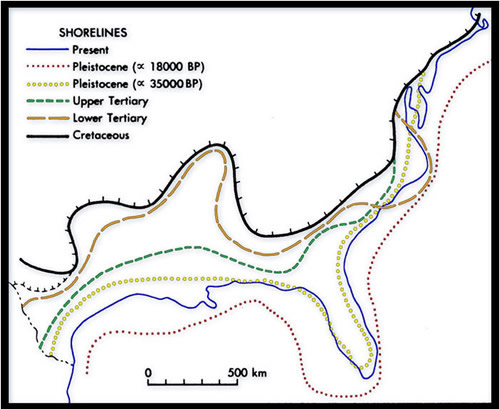
The clay is imported too, only on a different time scale. In some form or another, the Mississippi has been flowing for tens of millions of years, and all the while it has been carrying great loads of sediment -- in the eighteen-hundreds, some four hundred million tons per year -- which tended to settle out where the river, slowing, emptied into the sea. In this way, what is now the Louisiana Gulf Coast was formed out of bits and pieces of Missouri and Arkansas and Kentucky and Iowa and Illinois and Minnesota.
The buildup of southern Louisiana and its wasting away are flip sides of the same deltaic process. Over time, sediments naturally compact and consolidate -- or dewater -- with recent layers, which are wetter, losing volume more rapidly. Once enough sediment has been deposited, the load begins to depress the earth's crust, a process known as down-warping. (Down-warping occurs so gradually that the earth is still responding to sediment deposited tens of thousands of years ago.) In areas where accretion exceeds subsidence, new land is created. But the process works against itself. When too much sediment builds up at its mouth, the river, seeking a faster route to the sea, switches course, like a hose flopping around in the grass. A new bulge of land, or delta lobe, starts to form, while the old one slowly continues to sink, and compact under its own weight. In the past eight thousand years, the river has built five major lobes, some of them overlapping. Western Terrebone Parish is what remains of the delta lobe built during the time of the Assyrians; Lafourche Parish is what remains of the delta lobe laid down during the Roman Empire. Many still more ancient delta lobes are now submerged. The Mississippi fan, an enormous cone of sediment that was laid down during the ice ages, now lies under the Gulf of Mexico; it is larger than the entire state of Louisiana and in some places ten thousand feet thick.
The city of New Orleans sits on a lobe -- the St. Bernard -- that came into being around the time of the Pyramids. ...
[...]
After lunch, [U.S.G.S. ecologist Greg] Steyer unfurled a huge pre-Katrina satellite image of the wetlands. Everyone gathered around it. Several of the biologists had brought along post-hurricane images of the area, which had been laminated for use in the field. Even to the untrained eye, the differences were striking. Large areas that on the old map were green now showed up as black, which is to say, under water. Prior to the hurricane, there had been a hundred and thirty-three square miles of vegetated marsh in the area; according to initial estimates, the storm had eliminated thirty of them. There was a chance that some of these areas would eventually bounce back -- many of the clumps of brown marsh grass were already sporting tiny green shoots -- and it was possible that the soil that had been scoured away from one area would encourage new growth in another. In general, though, Steyer was pessimistic. "I can tell you the amount we lost in Breton Sound was bad," he said. "There is not going to be a net breakeven. Not at all."
[...]
Although almost no one in or outside New Orleans seemed prepared for it, Katrina was probably the most comprehensively predicted catastrophe in American history. In the past few decades, storm-surge models have become increasingly sophisticated and the computers they run on increasingly powerful. When researchers began to adapt the new models to New Orleans, they became convinced, as one of them put it to me, that "we had this train wreck imminent." ... The models showed that even if New Orleans's defenses held up, many possible hurricanes could overwhelm them, and that in the fastest-subsiding coastal parishes a relatively minor storm could prove devastating. Joseph Suhayda, a coastal oceanographer at L.S.U. who was working with a model that had been developed for FEMA, became so alarmed by the results that we began to buttonhole state and local emergency-management officials.
"I talked about it every place I could," Suhayda, who is now retired, told me. "It was a proactive effort to get the word out, to make it an issue." Some griped that he was just scaremongering -- "I've had people complain, 'Who is this guy, he's causing trouble.'" Suhayda said -- but others began to take notice. In October, 2001, Scientific American ran a story that described New Orleans as "a disaster waiting to happen," and warned that "only massive reengineering of southeastern Louisiana can save the city." The following year, the New Orleans Times-Picayune published a five-part, fifty-thousand word series entitled "Washing Away," which carried much the same message, and, the year after that, Civil Engineering, the official publication of the American Society of Civil Engineers, asked, "Can any defense ultimately protect a city that is perpetually sinking?" ... [Other predictions here and here. -- Ed]
[...]
The North Atlantic hurricane season officially begins on June 1st and ends six months later, on November 30th. The 2005 season started with Tropical Storm Arlene, which formed in the northwest Caribbean Sea on June 8th. By July 5th, there were already four named storms -- a record. By July 12th, there were five named storms -- another record -- and by July 31st there were seven, a third record. The season ended unusually late; Tropical Storm Zeta did not form until December 30th and persisted into the new year, finally dissipating on January 6, 2006. All told, there were twenty-seven named storms in 2005, or, at least, storms that would have been given names if the National Hurricane Center hadn't run out of them. ... Of these twenty-seven storms, fifteen grew into full-blown hurricanes, another record. Typically, three or four Category 5 hurricanes form in the North Atlantic in the course of a decade; in 2005, there were three in the course of a single year. Needless to say, this was also a record.
Hurricanes draw their strength from the warm surface waters of the ocean. As sea-surface temperatures rise, more energy becomes available to them, It follows that global warming should lead to an increase in hurricane intensity, but to what extent such an increase could be detected was still very much a matter of debate last spring, when Judith Curry and Peter Webster, climate scientists at Georgia tech, decided to investigate.
[...]
When she and Webster began their study, Curry told me once we were seated in her office, it wasn't because they expected to find anything very interesting. If storms were growing more violent in one part of the globe, this was, they suspected, probably balanced out by less activity in others. They set about assembling data on every single hurricane -- or typhoon, or cyclone -- that had formed in the North Pacific, the South Pacific, the Indian Ocean, and the North Atlantic since satellite measurement began, in 1970. (Because the wind shear is too strong and sea-surface temperatures are lower in the South Atlantic, hurricanes do not usually form there; however, in March, 2004, for the first time ever recorded, one did.) The survey revealed precisely the sort of correlation that Curry and Webster had thought didn't exist. Between 1975 and 2004, tropical sea-surface temperatures increased by roughly one degree Fahrenheit. During this same period, the number of storms reaching Category 4 or Category 5 status nearly doubled. The increase in hurricane intensity was statistically significant in all ocean basins. "It just sort of hits you over the head," Curry said. "There is no way you can explain this increase in every single ocean by natural, cyclical variability."
As it happened, at around the same time that Curry and Webster were at work on their study another researcher, Kerry Emanuel, at M.I.T., was conducting a similar study. Although Emanuel was analyzing different data -- he used wind-speed measurement taken by aircraft -- he reached the same conclusion. His study came out in Nature four weeks before Katrina. Curry and Webster's paper appeared in Science two weeks after Katrina. The following week, Rita struck. At that point, things "just sort of exploded," Curry said.
Eventually, Webster stopped by, and the conversation turned to the future of the Gulf Coast. "Are you aware of the size of Katrina's storm surge?" Webster asked. "On the Mississippi coast, it was twenty-eight feet high. Up the Biloxi River, twenty-four miles inland, I think it was twenty-four feet high. I don't know if you remember seeing the pictures of the tsunami versus the pictures of the Mississippi coast, but they were exactly the same. Now, that's going to happen again.
"What we're seeing is the base for what's going to occur in the future," he went on. "There will be ups and downs, but don't expect us to get back to a nineteen-seventies level of hurricanes." Webster called rebuilding New Orleans under these conditions "ludicrous."
Curry pointed out that, thanks to global warming, not only were hurricanes becoming more intense but sea levels were rising, making storm surges that much more dangerous. "What used to be the once-in-a-lifetime flood, you could see every season," she observed. In terms of rebuilding New Orleans, Curry said, "It's a complex issue. But, speaking from the climate and environmental-science perspective, a hundred years from now there's just no way there's going to be a city there. You just know that isn't going to happen. We can fight it. We can rebuild it and wait until it gets wiped out again. If you look at the geological record, these coastal areas come and go. Sometimes they're under water and sometimes they're not. Maybe a colossal engineering effort can do something, but at some point that is going to fail. This is just the way geology and climate work, You can't fight it forever."
The next day, I flew down to New Orleans to attend a meeting of a group called the Bring Back New Orleans commission, which was beginning to unveil its "action plan" for rebuilding the city. The Bring Back New Orleans commission was appointed by May Roy Nagin in September, 2005, and it exists in an uneasy relationship to the Louisiana Recovery Authority, which was appointed by Governor Kathleen Babineaux Blanco, and to the many federal relief agencies whose efforts are being coordinated by Donald Powell, an appointee of President Bush. The B.N.O.B. commission had spent two months drafting the plan, and, in the days leading up to the meeting, many of the details had leaked out, causing widespread alarm. ...
[...]
The meeting began with a presentation by John Beckman, a consultant from Philadelphia, who had been hired to work with the commission's urban-planning committee. Beckman flashed a series of slides on two huge screens flanking the podium at the front of the ballroom. ... [One] showed southeastern Louisiana, with areas of land loss expected by 2050 outlined in red. New Orleans appeared in brown, surrounded by big red blobs to the east, west, and south. "So we're in a threatened position," Beckman said.
[...]
...Finally, Beckman got to a slide titled "Neighborhood Rebuilding Strategy." The crowd perked up.
The slide showed a map of the city, with some areas colored yellow and other colored tan. Yellow neighborhoods were labelled "immediate opportunity areas." These areas, which included the French Quarter, the Garden District, and the Central Business District, had little or no flood damage, and the commission was recommending that they be reoccupied right away. All of the "immediate occupancy areas" were, not coincidentally, built on high ground ... Tan areas were low-lying neighborhoods, like Lakeview, New Orleans East, Gentilly, and the Lower Ninth Ward, which had taken on several feet of water. These were labelled "neighborhood planning areas." Neighborhood planning areas would be the subject of four months of public meetings, after which it would be determined -- how, exactly, was not specified -- whether they should be rebuilt or abandoned. ...
[...]
...Before Katrina, it was hard to know what your elevation was [in New Orleans], but now the water line around the houses -- New Orleanians refer to this as the "bathtub ring" -- gives it away. As we drove toward the river [from Lakeview], the line gradually dropped lower and lower until, just a few blocks before my hotel, it disappeared completely.
The following day, I headed east and took a walk around the Lower Ninth Ward. During Katrina, the Lower Ninth had remained relatively dry, until suddenly, after what sounded like a series of explosions, the water started rushing in. The explosions were, presumably, the noise of the flood walls giving way, but the led to rumors, which persist to this day, that the levees had been deliberately dynamited, as they were in Caernavon in 1927 [by New Orleans officials attempting to avoid the worst of the great Mississippi flood of 1927].
...Eventually, on Flood Street, I met three men standing in front of a white shotgun house. The house had been washed off its foundation and was sitting ten feet away from the concrete steps that used to lead up to it. Beside the steps was a small bush, now dead. ...
..."Listening to the Mayor saying, 'Come back," once you come back and see this city, you see he's just saying that stuff," [one man] observed. "It's hard to fathom." He gestured toward his father's house and the house next to it, which also had been swept off its foundation, and a third house which was listing crazily. "Would you want to rebuild this? I mean, really? What happens next September? Every year, it's going to be the same thing. ... No," [he] said. "Let it go."